Skip to header Skip to main navigation Skip to main content Skip to footer

Search form

Home
Eagle Nest New Mexico
Where the Mountains Meet the Lake

Main navigation

  • Home
  • Dining
  • Lodging
  • Shopping
  • Things to Do
  • Outdoors
  • History
  • Webcams
  • Business Directory

Carson National Forest

Greenie Peak by Forest Road 54: A Late-Season Climb Above the Moreno Valley
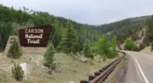
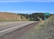
The Carson National Forest entrance sign beside New Mexico State Road 38 between Red River and Bobcat Pass, with forested slopes behind it.

From Eagle Nest, some of the best high-country driving in the Enchanted Circle begins with a paved climb. New Mexico State Road 38 rises east out of the Moreno Valley, crosses Bobcat Pass at 9,836 feet, and drops into Red River, and just beyond that corridor stands Greenie Peak, a summit of more than 11,200 feet in the Carson National Forest. The motorized way up is the Forest Road 54 system, a designated route that climbs toward the peak through pine and aspen forest, and in mid-November it offers Eagle Nest drivers one last look at the high country before winter takes hold.
  • Read more about Greenie Peak by Forest Road 54: A Late-Season Climb Above the Moreno Valley

Mule Deer in the Moreno Valley: Big Ears, Quiet Steps, and a Winter Coat

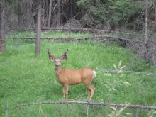
A mule deer buck with large ears and antlers in velvet stands in a green forest meadow.

If you are out on the roads around Eagle Nest at first light or in the last hour of the evening, watch the meadow edges. Mule deer are among the most familiar large mammals in the Moreno Valley, stepping out of the timber to feed where grass, sagebrush, and shrubs meet. The New Mexico Department of Game and Fish calls the mule deer perhaps the most widely distributed and best known large mammal in the state, and the deer here belong to the Rocky Mountain subspecies that inhabits the northern half of New Mexico.

  • Read more about Mule Deer in the Moreno Valley: Big Ears, Quiet Steps, and a Winter Coat

Late Fall on Moreno Valley Forest Roads: Getting Ready Before Winter

The Bobcat Pass summit sign on New Mexico State Road 38 in the Carson National Forest between Eagle Nest and Red River.

Early November is the in-between season for off-roading around Eagle Nest. The summer crowds are gone from the Moreno Valley, the aspens have dropped their leaves, and the high forest roads are still on the map, but the weather up there is no longer summer weather. This week, instead of pointing readers to one specific route, this Off-Road Friday is about getting ready: how to plan a late-fall drive on the designated forest roads around Eagle Nest so that the season ends with good memories and no rescue stories.

  • Read more about Late Fall on Moreno Valley Forest Roads: Getting Ready Before Winter

The Valle Vidal by Forest Road: A Designated-Road Drive from Eagle Nest

Snow-capped Wheeler Peak and Taos Mountain seen across the meadows and forests of the Valle Vidal.

For this Off-Road Friday, the ride from Eagle Nest is a drive, not a scramble: east on U.S. Highway 64 through Cimarron Canyon to Cimarron, then north a short way and left onto Forest Road 1950, the designated public road that crosses the Valle Vidal from east to west. The Valle Vidal, Spanish for Valley of Life, is a 101,794-acre mountain basin in the Carson National Forest northwest of Cimarron, in the Sangre de Cristo Mountains. It is some of the biggest, quietest country within a day trip of the Moreno Valley, and Forest Road 1950 is the way through it, on the road the whole way.

  • Read more about The Valle Vidal by Forest Road: A Designated-Road Drive from Eagle Nest
Subscribe to Carson National Forest

Eagle Nest, NM Weather

Loading current conditions...

Loading forecast...

Upcoming Events

🎉 Eagle Nest Events Calendar

Annual Favorites:
Fourth of July Parade, Barbecue, and Fireworks over the Lake
High Country Arts Festival — Late July, Enchanted Eagle Park
BalloonFest over Eagle Nest Lake
Fish Fest and Pike Round-Up — September, Eagle Nest Lake State Park

Article Archive

Browse past articles